Home
About
Our Team
Our Alumni
Our Partners
Contact Us
Publications
Publication Highlights
Publication List
Our Research
PHD Projects
Collaborative Projects
Resources
Conferences, Seminars & Workshops
PhD Presentations
Materials
Media

Planet A

Home
About
Our Team
Our Alumni
Our Partners
Contact Us
Publications
Publication Highlights
Publication List
Our Research
PHD Projects
Collaborative Projects
Resources
Conferences, Seminars & Workshops
PhD Presentations
Materials
Media
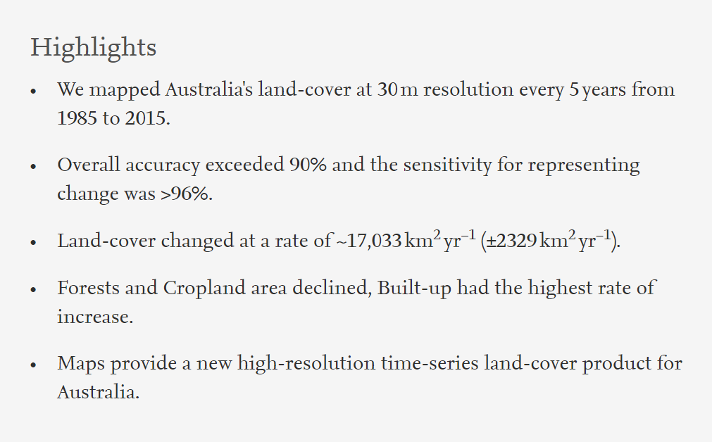
Brett Bryan
November 3, 2020

Australia's 30-year forest decline captured in new high-resolution mapping

Brett Bryan
November 3, 2020
Marc Gph.jpg
 
Marco 1.PNG
Marco Hlight.PNG
Marc Gph.jpg

Fig. 3. Australia's land-cover classification maps from 1985 to 2015.

View Full Article

Tagged: Australia, Land cover change, Remote sensing

Newer PostSustainable water consumption in China
Older PostImpact of climate change on NTFP ecosystem services in Nepal
Back to Top

DEAKIN UNIVERSITY, 221 Burwood Highway, Burwood, VIC, 3125,

AUSTRALIA 61+ (03) 9244 6100 planet.a.sustainabilityscience@gmail.com